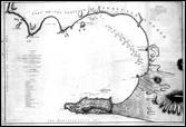

A chart of the Bay of Gibraltar, including a small plan of that Fortress with the position of the military & naval forces of France and Spain, present during the last siege of that Garrison

Andalucía

Spain

Utländska Krigsplaner. Nordamerikanska kriget 1775-1783 med åtföljande krig mellan Frankrike, England, Spanien m.fl. Nr. 4 �

1785

J. Cheevers

65 x 44

No scale


English


