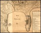

Carte de la Baye de Gibraltar

Andalucía

Spain

Utländska stads- och fästningsplaner. Spanien. Gibraltar 12. Carte de la Baye de Gibraltar

Around 1735

J.D. Grodemetz

65 x 53

French quarter of a degree and Toesas


French

The fortifications of the access to the rock by land have been added later in pencil.


